Airlines
UCCA commences Aerial Mapping and Photography in 14 Districts

Grand Master Plan for Entebbe International Airport
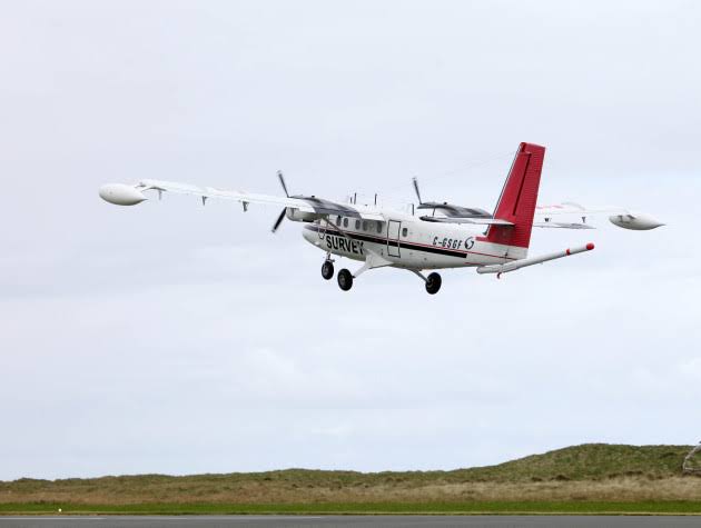
The Uganda Civil Aviation Authority (UCAA) is conducting an aerial photography and mapping survey in an area of 65km in the vicinity of Entebbe International Airport aiming at acquiring the Electronic Terrain Obstacle Data (eTOD)
This activity commenced on 7th April-2020.
The Uganda Civil Aviation Authority issued a notice announcing the exercise which will be carried out by Ramani Geosystems Ltd, from Nairobi Kenya will cover 14 districts anf four blocks of Uganda’s airspace.
These will include Masaka, Gomba, Butambala, Mpigi, Wakiso, Kiboga, Nakaseke, Luwero, Kampala, Mukono, Buikwe, Kayunga, Buvuma, and Kalangala Districts.
During the activity, three people aboard the survey aircraft will collect terrain and obstacle Data for three to five hours daily depending on the prevailing weather conditions calling for calmness in the affected districts in case they see a Cessna C208B aircraft over their airspace.
According to the notice, the data to be collected will help in the development of the airport and air navigation applications, set up eTOD and aerodrome mapping databases necessary for the update of aeronautical charts and aeronautical publications required for airport certification, update of on-board databases of flight management systems, airport ground movement and control systems.
“It also helps in setting up ground proximity warning systems, development of instrument flight procedures”. The notice reads
It adds “determination of maximum take-off weights, determination of contingency procedures for use in the event of an emergency, airport planning as well as land use studies and provision of geodetic control for engineering projects.”
Comments


